Destination
Dillberg: Hiking with outstanding views
Hiking Trails
Viewpoint
Interesting Facts
rest stop
Idea for a day trip with a change of scenery: the Dillberg. Enjoy the view of the Nuremberg region on the border between Upper Palatinate and Franconia!
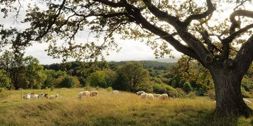
At just under 600 metres, the Dillberg in the Franconian Alb is the highest of the Neumarkt witness mountains and is known for its breathtaking views. When visibility is good, the view sweeps across Middle Franconia to the Upper Palatinate Jura landscape. Incidentally, the Dillberg is also the border mountain between Upper Palatinate and Middle Franconia.
The three-hour, moderately difficult hike starts at the railway station in Pölling, a district of Neumarkt in der Oberpfalz. From there, you hike almost six kilometres through an attractive landscape conservation area with wide fields and dense coniferous forests until you finally reach the Dillberg with its tall transmitter masts - the main mast is 231 metres high. The Dillberg transmitter has been operated by Bayerischer Rundfunk since 1955.
Hike from Pölling railway station to the foot of the Dillberg
From Pölling railway station, turn right from Bogenstraße onto Bergstraße. Turn slightly left at the next junction to stay on Bergstraße. Follow Bergstraße for 130 metres, then turn left onto Höllbachstraße. At the next fork in the road, continue right and then turn left again after a few metres. After one kilometre, Höllenbachstraße becomes Am Herrnhof, which you follow for approx. 1.5 kilometres to the end. At the end of the road, you cross the B8, after which a winding path leads directly into the nature reserve. A row of allotments can be seen, before which you turn left and take another look at the village of Pölling. Immediately afterwards, turn right onto the ascending path that leads into the forest and up to the Schlossberg - at the top, follow the signposts marked with a yellow line to reach the plateau of the Dillberg via wider paths.
Pack your binoculars and enjoy the panoramic view
Once at the top, an impressive panoramic view of the Upper Palatinate, Middle Franconia and the Bavarian Jura awaits in fine weather. The Nuremberg telecommunications tower, 27 kilometres away, and Nuremberg Castle can also be spotted. With the best visibility and binoculars, you can even see the Swabian Alb.
Then it's back downhill and along the Eppeleinsweg trail - past the Bucher Höhle cave - towards Ezelsdorf, before passing through the villages of Dillberg and Kleinvoggenhof on the return leg of the circular hike. Tip: Be sure to pay a visit to the freely accessible Buch Cave (also known as the Dillberg Cave or Silbersand Cave), which is around 70 metres long and has many branches! The cave was carved out of the sandstone by local farmers between the world wars and was used as a shelter. If you follow the Eppelsteinweg and the signposts, the path leads back to the village of Buch. Passing through the village, the path returns to the edge of the forest - from here you take the way back towards Pölling railway station.
Stop for a bite to eat and recharge your batteries
Enjoy a hearty meal at Landgasthof Goldene Krone, fortify yourself with Italian pizza at Sicilian Mauro or stop off at the traditional family-run Zur Linde inn - a variety of culinary destinations await hungry hikers.
Goldene Krone "Bucher Wirt" country inn
Directly after the descent from the Dillberg, the traditional country inn Goldene Krone "Bucher Wirt" awaits hungry hikers in Buch with sumptuous portions at reasonable prices. In addition to popular classics such as schnitzel, cordon bleu and wedding soup, you can also enjoy baked carp (from September to April). The inn is located directly on the way back towards Pölling, just 15 minutes away from the Bucher Höhle cave: after about 10 minutes of walking, the narrow hiking trail turns into a wider road that leads directly to Buch. If you keep right here towards the village, you will find the inn after a few metres on the left-hand side of the road, where you can stop for a bite to eat without any detours.
Osteria da Mauro
Fancy a tasty stone-baked pizza and Italian cuisine? Then FC Ezelsdorf's club restaurant Osteria da Mauro in Bucher Straße is the place to go. Chef Mauro, who comes from Sicily, and his team spoil their guests with home-made classics from Bella Italia. Once you reach the Bucher Höhle, don't head back in the direction of Buch, but keep going in the direction of Ezelsdorf. After around 20 minutes, you will reach the Ezelsdorf sports field and football pitch. Follow the path along the field before turning off to the right, which takes you directly to the Osteria.
After refreshments, you can either take the same route back towards Bucher Höhle or turn left onto Bucher Straße towards the sports field, which ultimately leads back to Buch and Pölling via wide country lanes. If you want to shorten the way back a little after stopping for refreshments, you can also follow the road towards the centre of Ezelsdorf, turn left onto the Bahnweg at the main road and then reach the village and train station "Oberferrieden" after about 30 minutes. From the railway station, you can take the S-Bahn back home after the Dillberg hike.
Gasthaus Zur Linde
Right in the centre of Burgthann-Ezelsdorf is the family-run Zur Linde restaurant with its pretty beer garden, generous portions and fair prices. Particularly popular: the currywurst and shashlik! After the culinary break, the route heads home again: take the main road to the "Bahnstraße", which branches off to the right and leads directly to the village of Oberferrieden and the railway station of the same name, "Oberferrieden". Instead of starting at Pölling station, the hike ends at this station. From the station, you can take the S-Bahn in the direction of Nuremberg or Neumarkt.
Listen to this episode of the podcast series "Hin & Hören" and discover what else the Nuremberg region has to offer around the Dillberg. Plan your trip by train!
Arrival
Dillberg
Dillberg 1
92353 Postbauer-Heng
Dillberg 1
92353 Postbauer-Heng
Pölling
Our tip: Please make sure to check your train connection and the expected capacity before you start your journey.