
Bahnhofstraße 7
91224 Pommelsbrunn
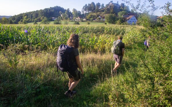
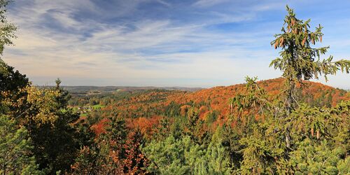
This hiking tour through the Birglang takes you uphill and downhill through fabulous scenery with magnificent views of the surrounding countryside. Moss-covered rocks, orchid trail and enchanted forest. Take the railway to Birgland.
A hiking tour for nature lovers and explorers
Our tip: Please make sure to check your train connection and the expected capacity before you start your journey.
The best way to get to the start in Poppberg, almost 600 metres above sea level, is to take the Birgland Express 479 from Hartmannshof station or the daily bus from Sulzbach-Rosenberg. The route first takes you to the Martin Luther Church, right next to the bus stop. And there's something very special: the church is not just at the top of the village, but right on the European watershed! This means that the water that falls on the southern half of the roof flows towards the Danube and into the Black Sea, while the raindrops that land on the northern side (= street side) rush down to the Rhine and into the North Sea!
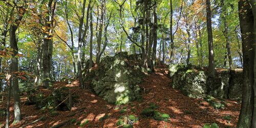
You walk just half a kilometre and enter a pristine, mysterious forest. Stone "balls" covered in moss lie around as if giants had played with them. The mountain up there is the Poppberg, 653 metres high - a surprise is waiting there, well hidden.
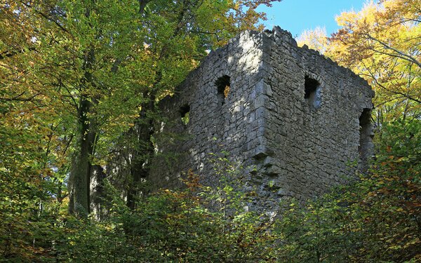
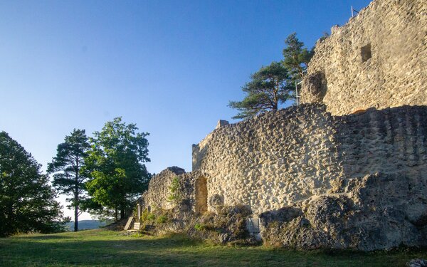
We are amazed to see it for the first time as we approach: A stone wall towers up in front of us on the south side, the imposing remains of the old Poppberg Castle! A real highlight, nothing has been restored or retrofitted with railings and steps, everything radiates original charm. The ruins of this high medieval aristocratic castle from the 13th century can be entered and viewed with great care, climb in or crawl out, but always at your own risk. Three storeys are still preserved, and the castle probably had at least one more storey originally. During the Second World War, there was an air traffic control centre here that monitored air traffic around Nuremberg and reported every aircraft to the control centre there.
The private area with the highest point may be entered at your own risk. You walk back down to the signpost by the tree on the wide path and take the narrow path, which sometimes winds slightly uphill through the forest.
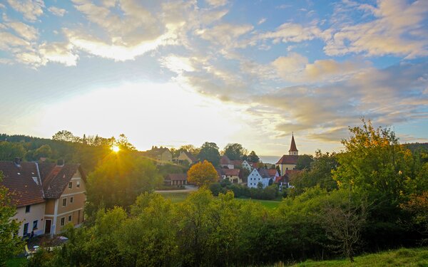
In the next village, Eckeltshof, the stately "Zum Ritter" inn serves fresh regional dishes "straight from the forest, water, meadow and pasture". There is also a 424 bus stop. The route continues to Buchhof. The next highlight is announced next to a beautiful farm garden: Signpost Bärenfelsen, 1.3 km.
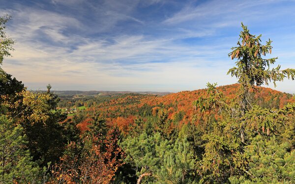
First climb 250 metres up the beautiful forest path, then turn left and after 250 metres turn left again. Now you walk over roots and past "moss balls" and rocks to the summit. This time there is a wonderful distant view, far to the north over Birgland and across to Hersbrucker Schweiz.
Back at the junction, continue straight ahead along the rooty earth path. It winds its way through the forest between the 651 m high Kappersberg (left) and the 603 m high Fuchsberg (right). You then pass a small fenced-in water lily pond on the right. Continue downhill across open countryside, past a playground and light-footedly into Fürnried (km 9.8).
On the village square, which has been awarded gold and silver, you "have to" choose between the Färber "Goldener Stern" country inn and the "Goldener Hahn" pub. The Birgland Express 479 serves the two bus stops (at the top of Dorfstraße and the larger one on the village square), and there are also connections to Amberg and Sulzbach.
In memory of the founder of the Neuendettelsau Mission in New Guinea, there is a permanent exhibition in the former school building at Schulstraße 4 (turn right after the village square) about the interesting life and work of Fürnrieder Johann Flierl, who wanted to become a missionary as a child.
Schulstraße 2
92262
Birgland

The Birglandtrail markings lead you out of the village in the direction of Wurmrausch. Turn left at the bus stop and walk straight on for approx. 200 metres through the long village after the right-hand bend. At the crossroads, continue straight ahead up the grassy path. Further up, the wooden house on the wider path remains on the left. Our narrower path goes straight up. On the right, trees of the same size standing very regularly catch the eye: poplars are cultivated here for sustainable heating with woodchippings. Now comes the most rustic part of the trail, it gets really steep and rooty! Suitable footwear and at least a little surefootedness are recommended on the sometimes steeply ascending or descending paths. Another highlight awaits you on the 500 - 600 metre high mountain ridge: marked, in addition to the Birgland Trail markings, with no. 34 as the Magic Forest Orchid Trail. You wind your way up 100 metres in altitude on the forest root path, past the familiar "moss balls" and over to the tall but narrow climbing rock faces.
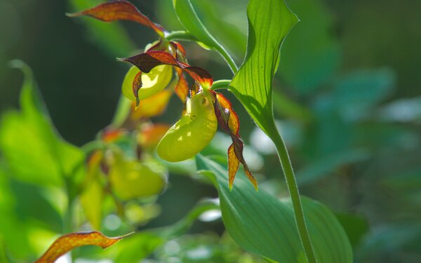
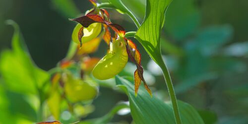
The yellow lady's slipper, a rarity elsewhere, blooms from around mid-May to mid-June. It finds ideal conditions here, as it needs light partial shade, varying moisture, poor and, above all, loose limestone soil. To ensure that it can continue to exist, it is very important to maintain the loose soil and not to compact it through careless trampling. What makes this location really valuable are the magical accompanying plants, such as the blue columbine, the black-fruited St. Christopher's orchid and other orchid species, such as the fly orchid, the nest orchid, the two-leaved wood hyacinth and the green wood hyacinth, also known as the mountain wood hyacinth.
Because this idyll is under threat, we have a big request to all photographers and passers-by: Please stay on the paths so that we can preserve these unique beauties! Unfortunately, footsteps compact the loose forest soil that is so important for them. In compacted, hard-packed soil, vital CO² and water can no longer penetrate.
Lichtenegg 2
92262
Birgland
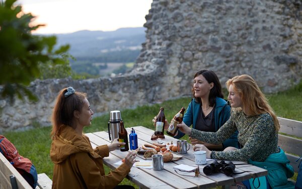
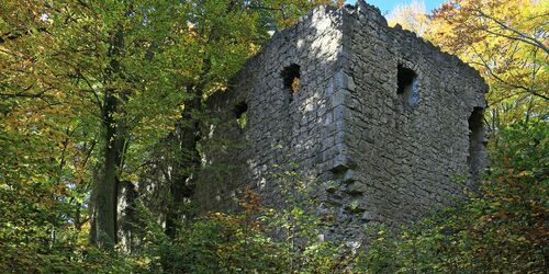
You pass the Türkenfelsen with its rock gate and the Emilfelsen, strange-looking, wall-like high rock faces covered with round holes. High up on the ridge, the small paths often branch off, so pay close attention to the markings. Finally, descend steeply into a depression with an open field and climb back up over a stony step. Where the root path makes a left turn uphill and meets a cross-path, you can make an almost flat detour to the right to the Lichtenegger Wand. Back on the marked path, you walk uphill again a little before passing the Kronberg (on the right) at 599 metres. This is the end of your "flight of fancy", as the descent becomes steeper and steeper. Almost at the bottom, a bench peeks through the trees on the left, which turns out to be the best place for a snack with a view of Lichtenegg Castle. The path leads past it, you emerge from the forest and come to the road. There is another bus stop here, but the Birgland Express does not stop here, but 900 metres further on in Tannlohe. You now walk towards the ruins of Lichtenegg Castle. After the raised square with several information boards, you reach the Alter Schloss-Wirt inn. Here you can rest and relax and enjoy Franconian specialities and chilled beer, soft drinks etc. on the spacious self-service terraces. You can climb up to the Lichtenegg castle ruins (km 13.8) at an altitude of 585 metres via the private staircase at your own risk.
This is also the remains of a former aristocratic castle, which was first mentioned more than 700 years ago in the Nuremberg Reichssalbüchlein, but is probably much older. This area was already inhabited over 3000-5000 years ago, as Corded Ware finds prove. The castle belonged to the imperial bailiwick of Nuremberg for a time in the Middle Ages and changed hands frequently until its destruction in the 15th century. Now owned by the municipality of Birgland, it has been restored with private funds since 1998. The former keep, palas and castle walls give an idea of its former size and importance. Built from almost white limestone, it shines from afar, high above the village of Lichtenegg. Stairs have been added and we climb up 585 metres in comfort. At the top, a unique view opens up towards Franconia and the rougher, northern Upper Palatinate.
Lichtenegg 7
92262
Birgland

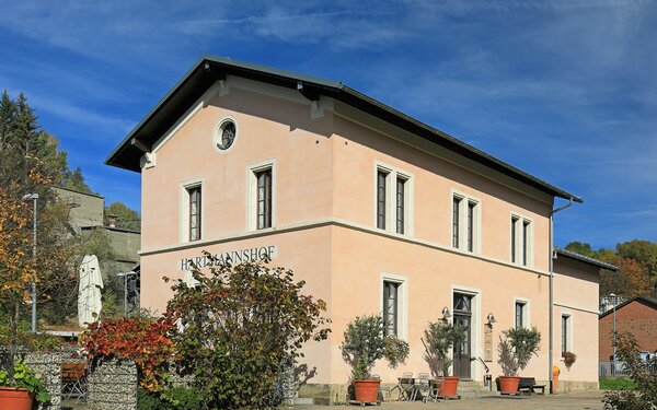
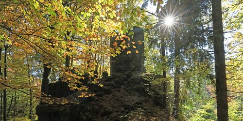
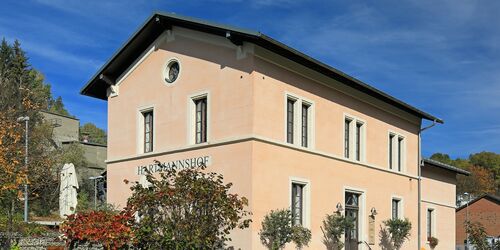
Descend steeply for a short distance as an extension of the steps, turn left at the wider crossroads and then right at an acute angle at the next path. Watch out at the beginning of the forest! The marked narrow path leads off to the right of the wide path and can easily be overlooked. Here you cross the border from Upper Palatinate to Middle Franconia. With many marked bends, you walk through the forest to a wide path with a signpost for Haunritz. Descend along a steep and narrow meadow path with a few steps, flanked by llama pastureland. A panoramic descent of the finest quality, on which we soon come face to face with the Old Fritz - twice over: first we see the "Zum Alten Fritz" inn, then the associated viewing rock. This dolomite rock, the village's landmark, is said to resemble the Prussian king Frederick the Great. The Haunritz, Zum Alten Fritz bus stop is also located at the inn. You reach the village square with its striking climbing fountain, pass an ancient paper mill, a beer garden and a large playground, even with a barbecue area. You then walk through several archways of Haunritz Castle dating back to 1719, before turning left at the crossroads. Before that, you can take a short detour to the right to the fish pond at the fountain and to interesting old weir systems - a whole system - with the Herrenmühle mill opposite. On the grassy path in the Högenbach valley, you can look forward to some enjoyable final kilometres in the valley. The stone walls of a moss-covered ruin appear on the left-hand side of the path, and the sound of rushing water becomes louder and louder: a karst spring pours out strongly and bubbles vigorously, a welcome refreshment in summer. Continue past the Hartmannshof waterworks and turn left just before the Fallmühle mill. Another scenic path follows, high above Weigendorf with a view over to the Hartmannshof quarry. At the end, in the old station building at the railway station, the prehistory museum Urzeitbahnhof and an osteria invite you to finish.
A very special treasure can be seen here: The wisdom tooth of a Neanderthal is the oldest evidence of a human in Bavaria to date. The exhibits at the Prehistory Museum Urzeitbahnhof invite you on a "journey through time" into the past, from the Stone Age hunters around 12,000 years ago through all periods of prehistory to the end of Celtic civilisation around 15 BC. You will learn interesting facts about Celtic hunting, food sources, places of worship and sacrifice as well as ideas of the afterlife at the time.
It is best to enquire about the current opening times by telephone.
Bahnhofstraße 7 A
91224
Pommelsbrunn
The return journey is by S-Bahn S1 from Hartmannshof station in the direction of Nuremberg.
Start/Ende
HartmannshofBahnhofstraße 7
91224 Pommelsbrunn