Josefshöhe Dettelbach, Foto: Michel Taileffer Weinbergblick auf Dettelbach, Foto: Gerlinde Schadel Historisches Rathaus am Rathausplatz in Dettelbach, Foto: Uwe Miethe, Lizenz: DB AG Blick durch das historische Faltertor in die Falterstraße, Foto: Uwe Miethe, Lizenz: DB AG Über die Höhe Blick nach Dettelbach, Foto: Tobias Reissmann Türme an der östlichen Stadtmauer Dettelbach, Foto: Uwe Miethe, Lizenz: DB AG Bibergau Schloß, Foto: KUK An der östlichen Stadtmauer von Dettelbach, Foto: Uwe Miethe, Lizenz: DB AG Weinberg auf dem Sagen- und Mythenweg Dettelbach, Foto: David Rauch Josefshöhe mit Ausblick, Foto: Reissmann
Tour

Legendary Middle Ages in Dettelbach

Fine wine
Castles
Animals & Nature

Are you interested in history and culture? Then this hike is perfect! Discover colourful half-timbered houses, the medieval town wall and the rich world of Dettelbach's myths.

Start
Dettelbach
Duration
6 h
Distance
15 km
Key facts of the tour
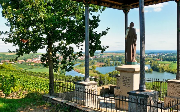
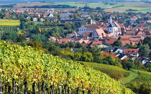
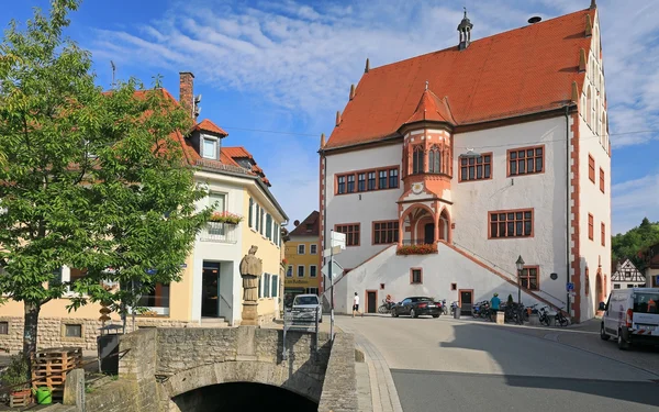
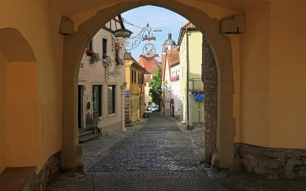
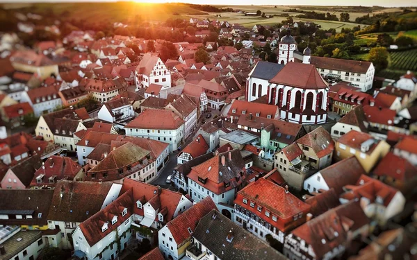
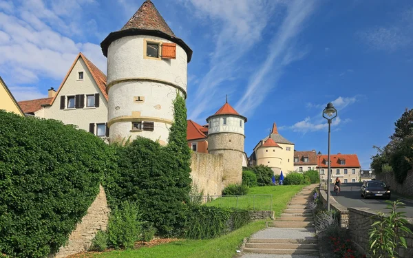
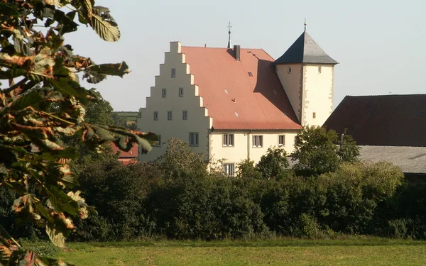
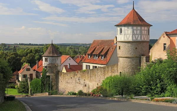
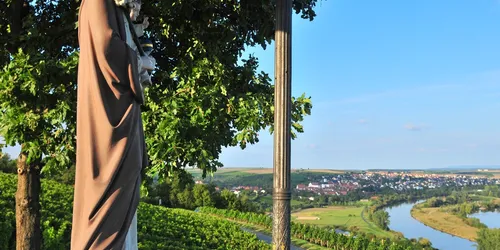
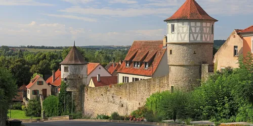
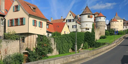
Surrounded by vineyards lies the enchanting little town of Dettelbach with its colourful half-timbered houses and the medieval town wall with its gates and towers, of which the old ring wall once had 52.

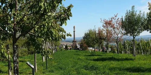
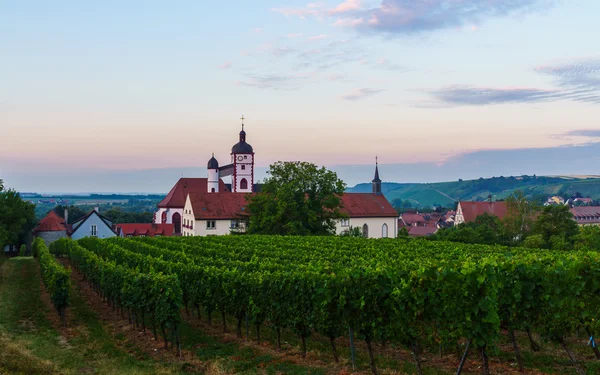
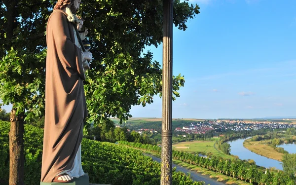
But this hike has even more to offer. It takes you to a former moated castle, immerses you in the rich world of myths surrounding Dettelbach and shows you fabulous views over the Main loop and vineyards.
A hiking tour for explorers, families and nature lovers

Start and end station

Start station
Dettelbach Bahnhof
4 tour steps
15 km / 6 Stunden
End station
Dettelbach Bahnhof

Our tip: Please make sure to check your train connection and the expected capacity before you start your journey.

Schedule

Tour starts on Dettelbach Bahnhof

Direction

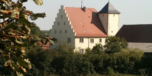
Dettelbach railway station is not in the village. From here, head east before turning north after 300 metres and walking into the gentle hills of Effeldorf. Head east again until you turn left on the outskirts of Bibergau. On Effeldorfer Straße, which soon becomes Ritterstraße, turn right and you will find Bibergau moated castle on your left.

Bibergau Castle

The clustered village of Bibergau was founded in the Franconian country house building period in the 8th and 9th centuries. With its 610 inhabitants, it is the largest district of Dettelbach. Its silhouette is dominated by the towers of the two most important buildings in the village: the parish church of St Simon and St Judas and the moated castle.

Bibergau Castle is a former aristocratic residence. Unlike most other castles in Franconia, the history of the castle does not go back to the Middle Ages. A predecessor building was constructed in the second half of the 16th century. The square tower in the south-west and elements of the residential building have been preserved from the originally probably larger complex of the former moated castle, as has part of the moat in the east.

In the same century, the Fuchs von Bimbach family became owners of the complex and erected today's Renaissance buildings. From 1613 until the 20th century, the castle belonged to the Lords of Seckenheim and Reinhard von Mauchenheim called Bechtolsheim.

Today the castle is in private hands. The upper floors are inhabited, while cultural and gastronomic events take place in the basement.

Ritterstraße 22
97337
Dettelbach-Bibergau

Bibergau Schloß, Foto: KUK

Direction

Continue along Ritterstraße until you reach the parish church of St Simon and Judas. It is worth taking a look inside. It contains a graceful rococo interior and a unique wayside shrine plaque.

Here you turn left into Lindenstraße, which you follow out of the village. Now you walk along the Bibergauer Mühlbach stream until you turn left beyond a crossing stream to continue walking through vineyards.

At the "Winzerhof Kieselsmühle" (Schweinfurter Str. 30, 97337 Dettelbach, tel. 09324 33 88) you have the opportunity to taste some wine. The route then continues to the romantic little town of Dettelbach with its winding alleyways and colourful half-timbered houses.

Dettelbach town fortifications

The old town centre of Dettelbach is still surrounded by a largely preserved town wall with towers, gates and the remains of moats. It dates back to the turn of the 16th century. At that time, the town was granted town and market rights by Emperor Frederick III.

The fledgling fortifications experienced their first military conflict during the German Peasants' War in 1525, but during the Thirty Years' War they were no longer able to withstand modern artillery and the population opened their town to the Protestant Swedes without a fight in 1631.

The appearance of the castle changed constantly over the following centuries. For example, many of the small wall extensions and some of the once probably 52 towers disappeared. In 1872, three of the five medieval gates were demolished because they hindered the increasing traffic of carts. In the following decade, a circular park was laid out in the south for the local population.

The spirit of the times finally changed in the 20th century. The value of the ring wall as an architectural monument was recognised. Today, it still surrounds almost the entire old town centre of Dettelbach. A particularly large number of the 30 or so remaining towers can be seen along the eastern city wall between the former Neutor and the Faltertor, the more important of the two remaining gates.

A typical example of the development of the wall towers is the so-called Rössnerturm at Östliche Stadtmauer 3. The defence tower was converted into a residential building in the 19th century by adding a half-timbered extension. The so-called Mainstockheim Tower at Stadtgraben 6 is considered to be the oldest surviving remnant of the town fortifications and is thought to date back to the middle of the 15th century. The men's tower was the town prison until the 19th century. Today, together with the Faltertor gate, it is a popular photo motif.

Am Stadtgraben 6
97337
Dettelbach

An der östlichen Stadtmauer von Dettelbach, Foto: Uwe Miethe, Lizenz: DB AG

Direction

You leave the medieval old town via Würzburgerstraße and Kolpingstraße. This is where the Dettelbach legend and myth trail begins.

Dettelbach legend and myth trail

Dettelbach is many centuries old. Naturally, people have told each other one or two old legends over the years. The legend and myth trail leads for around two kilometres through the vineyards and Dettelbach meadows. Hikers not only learn exciting myths about Dettelbach on twelve boards, but also interesting facts about the geology of the Main, the development of agriculture and viticulture in the region.

Along the way is the Sieben-Köpfe-Marter - a boundary stone between the lands of the former authorities of the Diocese of Würzburg and Münsterschwarzach Abbey. The 8.5 metre high Herz-Jesu monument on the hill of the same name was erected in 1900 by the citizens of Dettelbach in the hope that the new century would be a blessed time. From here, the view extends over the vineyards, the Main and as far as the Steigerwald and the Schwanberg. The Münsterschwarzach monastery, six kilometres to the east, can also be seen from here.

Rathauspl. 1
97337
Dettelbach

Weinberg auf dem Sagen- und Mythenweg Dettelbach, Foto: David Rauch

Direction

From the twelfth signpost on the Legends and Myths Trail, take a few steps back to signpost 11 and continue straight ahead towards your next destination: Josefshöhe. To get there, hike down once and then up a small ascent. It is well worth it. By the way, you are now back on the TraumRunde Dettelbach. Here you will learn one last time about Dettelbach's world of legends.

Josefshöhe

The Temple of St Joseph was built in 1892 by the winery owner Johann Knauer and is also the logo of the winery today. The temple in the Mainstockheim mountains is a stepped complex with the figure of St Joseph with child. From under the romantic canopy, there is a marvellous view of the Dettelbacher Mainschleife and the Steigerwald.

Josefshöhe mit Ausblick, Foto: Reissmann
Aussichtspunkt Josefshöhe, Foto: Gerlinde Schadel

Tour ends on Dettelbach Bahnhof

Direction

Now you have had your fill of the beautiful Main valley. The vineyards and the TraumRunde Dettelbach trail accompany you for a while, which you leave to the left at the highest point of today's tour at 284 metres. From now on, you remain at roughly this altitude and walk westwards through fields.

After a short stretch along the state road, you follow the Mühlgraben from the outskirts of Bibergau back to the railway station

Tour map

Start/Ende

Dettelbach Bahnhof

97337 Dettelbach

More destinations

This tour through romantic Franconia fulfils three wishes at once: nature, culture and enjoyment.... Travelling by bike in the footsteps of the Romans. On this tour from Treuchtlingen, you will... On this hiking excursion to Karlstadt, you will first explore the old town before travelling... Summer in the city: "Knaus Campingpark" is incredibly peaceful, despite being right in the middle... Beer garden tables in the shade of old chestnut trees, beer and hearty dishes all add up to a... The Bayreuth ice cream paradise "Opera" is just an eight-minute walk from the station. The café... If you like romance, this is the place for you. On this walk in the town of towers, you can expect... Discover the Main in a very special way: by canoe! Paddle from Lichtenfels to Ebensfeld and enjoy... Modern glass art, cult toys and an amusement park await you on this cycle tour along the Röden -... Where tradition meets modernity: Ice cream café "Benito" in Würzburg has been around for 84...