
Bahnhofplatz 1
97753 Karlstadt
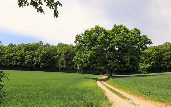

Discover the beauty of the Franconian wine country on a hike that offers you the diverse nature of the Karlstadt drylands, the breathtaking panoramic view from the ruins of Karlsburg Castle and exciting insights into the region.
A hiking tour for nature lovers, culture vultures, families and explorers
Our tip: Please make sure to check your train connection and the expected capacity before you start your journey.
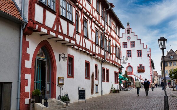
It is only a few steps from the railway station in Karlstadt to the old town centre. Follow the K2 signs through a medieval town centre with buildings steeped in history, such as the parish church of St. Andreas and the Main Gate.
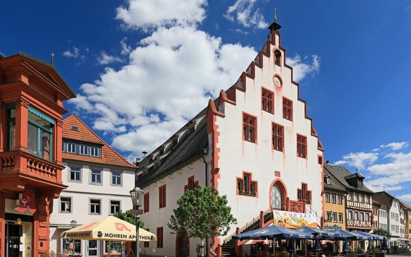
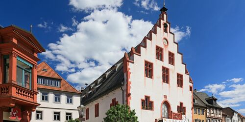
Take your first short break at the market square to take a look at the historic town hall.
The historic town hall dominates and adorns the market square in the centre of the old town. Built in 1422 as a council, merchant and dance house, it epitomises the archetype of a German town hall. The market hall on the ground floor has three naves and the citizens' hall on the first floor is still the largest of its kind in Franconia.
The façade with its stepped gable facing the market square gives the otherwise rather plain exterior its unmistakable character. The double flight of steps originally provided the only access to the upper hall.
The little bell tower of the town hall clock crowns the ridge. Above it, in a niche, stands the "Schwedenmännle", created in 1718 by the Karlstadt sculptor Kilian Schüßler. Five times a day, it sounds its lansquenet tune "From the beret the feather sways".
It can be heard every even hour from 2 p.m. to 8 p.m. throughout the Old Town.
Marktplatz 1
97753
Karlstadt
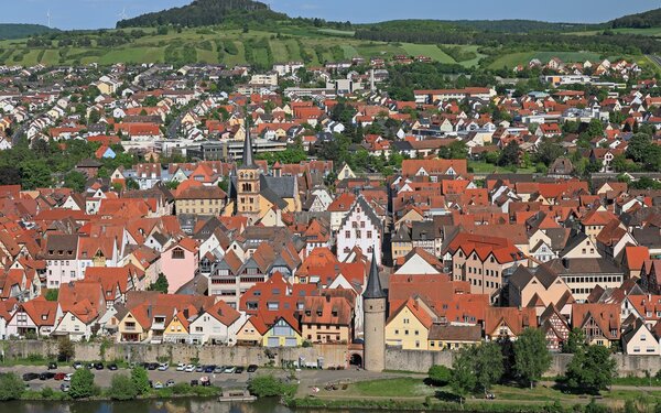
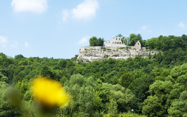
The view across the market square down to the Main Gate with the ruins of Karlsburg Castle in the background tempts you to climb up to the castle ruins straight away.
To do so, follow the main road to the more than 750-year-old Oberer Torturm or "Katzenturm" - one of the highest of its kind in Franconia.
Turn right, cross the Main on the Old Main Bridge and take the small staircase on the right on the other bank, which leads you down from the bridge.
Now follow the signs to the Burgweg. It leads you through a species-rich high forest up to the ruins of Karlsburg Castle, from where you can enjoy the view of pretty Karlstadt and the landscape in the opposite direction.
Anyone who has made the short climb up to Karlsburg Castle will be rewarded with a breathtaking view over Karlstadt, the surrounding area and the Main Valley. Excavations in the 1970s and 1990s show that the ruins had several predecessor buildings dating back to the Merovingian period in the 7th century.
The castle hill, naturally secured to the south and east by steep slopes, was fortified to the west and north by a system of ditches and ramparts. During a second construction phase in the 10th century, a wall with square bastions was erected.
In the 13th century, the prince-bishops of Würzburg levelled the old fortifications and built the stone Karlsburg, which is still in ruins today, on the same site. In 1409, the indebted Bishop Johann von Egloffstein had to pledge the castle to the cathedral chapter, in whose possession it remained for almost 90 years. During this time, a much admired well some 60 metres deep was built.
In spring 1525, shortly before the Peasants' War in Würzburg was bloodily suppressed, the people of Karlstadt destroyed Karlsburg Castle after much hesitation. Stone robbers plundered the remains until the middle of the 19th century. Since then, it has towered over Karlstadt in its present form.
Burgweg
97753
Karlstadt

After an extensive visit to the castle ruins, cross the Schlossberg.
Now follow the K10 signs and you will soon reach the Rammersberg nature reserve.
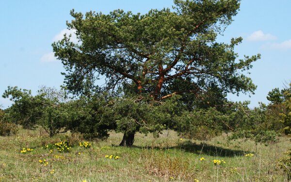
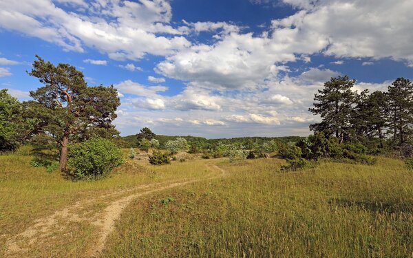
The Rammersberg nature reserve is part of the Karlstadt drylands and is characterised by a remarkably warm climate and low rainfall. The interplay of climatic and geological conditions and the influence of centuries of human cultivation have created a complex mosaic of habitats here: Dry grasslands, fringes, scrub, coppice, fallow fields and extensively utilised orchards.
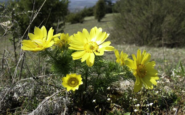
Spring is a particularly good time to visit, as the Karlstadt dry grassland is one of only a handful of small areas in Germany where the endangered and strictly protected adonis rose can be found. Its name, which promises beauty, goes back to Greek mythology. Aphrodite wept for her favourite Adonis after his death, and a white rose grew from each tear. From the drops of the dying man's blood, however, grew Adonis roses, whose species bloom in bright red or, as here, golden yellow.
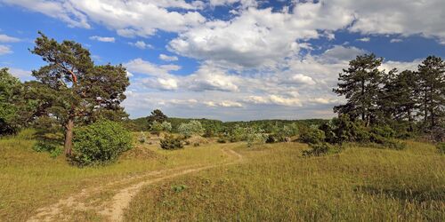
Explore the nature reserve at your leisure and then walk a little further.
Where trail K10 crosses K3, follow the K3 signs to the left towards the railway tracks until you reach Wiesenfeld, the largest district of Karlstadt in terms of area.
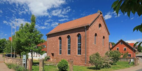
Here you will find your third stop: the former Wiesenfeld synagogue.
Wiesenfeld has an eventful Jewish history. In the middle of the 17th century, Jews who had been expelled elsewhere began to settle in the village. Around 1800, every seventh person in Wiesenfeld was Jewish. In 1848, the Jewish community had 125 members.
Around 1862, the community was given a new synagogue in the Gothic style. Although the building survived the Kristallnacht in November 1938, it was no longer usable. Members of the SA had destroyed or looted the entire interior. 22 of the 25 deported Jews from Wiesenfeld were murdered.
Since its restoration in 1993, cultural events, exhibitions and concerts have been held in the former synagogue. Guided tours and visits are available on request. (Tourist Information Karlstadt, Hauptstraße 9, 97753 Karlstadt, Tel. 09353 906688)
Erlenbacher Str./Schloßmannsgasse
97753
Karlstadt
The path leads you back via Schloßmannsgasse onto Roter Rain and along Hausener Straße for a short distance.
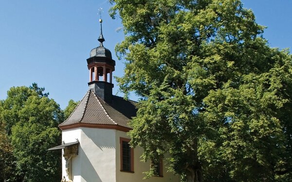
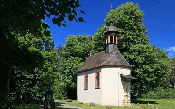
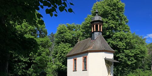
Leave this road and follow the signs for the K6. The route leads uphill through fields to a small wood. The Kreuzkapelle chapel awaits you in a beautiful clearing.
Built in 1721, the chapel on the Erlenberg, north-west of Rohrbach, is a simple building with a ridge turret and a small bell. The left-hand French window can be opened to reveal the interior of the chapel.
The interior was decorated in 1868 with stencil paintings depicting stone blocks, columns, a ceiling frieze and a tapestry. After being painted over in white in the middle of the 20th century, the chapel was renovated at the beginning of the millennium. Since then, the interior has been restored to its historicist style.
The chapel was preceded by a wayside shrine in the same place, which is the subject of a legend. This is where a shepherd from Urspringen is said to have found his flock, which had scattered during a thunderstorm. He erected a wayside shrine vowed in his distress.
The chapel is located at a crossroads of once important mountain paths. Over the years, hikers, carters and horsemen are likely to have made so many donations to the offering box at the wayside shrine that the chapel was built at the beginning of the 18th century and a chapel foundation was established.
At the Kreuzkapelle chapel, turn left and follow the K6 signs towards Rohrbach and its parish church of St Valentin with its striking onion dome.
Cross the village street of Rohrbach, turn onto Steinfelder Straße and follow the signs for K6, then K5 to Schlossberg.
Here, the K2 leads you onto the educational wine trail and panoramic path in the middle of the Mühlbacher Fronberg vineyard. Learn all kinds of interesting facts about the grape varieties grown here, from Silvaner to Domina.
On your way back to Karlstadt railway station, why not stop off at one of the traditional wine taverns? Or visit one of the Heckenwirtschaften, where you can sample regional Franconian wine and small dishes.
Start/Ende
Bahnhofplatz 1
97753 Karlstadt