
Bahnhofplatz 1
97753 Karlstadt (Main)
A hike through the Grainberg-Kalbenstein-Saupurzel nature reserve on the banks of the River Main. Enjoy the panoramic view from the summit of the Kalbenstein on a trip on the railway.
A hiking tour for nature lovers and families
Our tip: Please make sure to check your train connection and the expected capacity before you start your journey.
The starting point is the railway station in Karlstadt. Just after the subway, you will find the signs for the K1 hiking trail, which you will follow the whole way.
You walk through eastern Karlstadt and pass Karlstadt-Saupurzel airfield. At weekends and in good weather conditions, you can watch aeroplanes take off and land here.
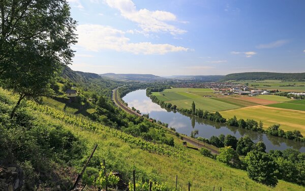
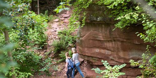
You cross Eußenheimer Straße and are now in the middle of the Grainberg-Kalbenstein-Saupurzel nature reserve.
The Grainberg-Kalbenstein-Saupurzel nature reserve offers one of the richest plant and animal worlds in Bavaria. This area stretches east from Karlstadt to Gambach and is characterised by different habitats and geological formations, from shell limestone bastions to red sandstone terraces and vineyard walls.
Due to the climate, the soils provide a habitat that only special animal and plant species can cope with, including many that are otherwise more likely to be found in steppe regions or the Mediterranean. The Karlstadt saxifrage was only discovered here in 1998 as one of five endemic plants.

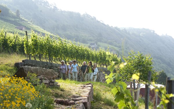
Enjoy the unspoilt hiking trails amidst this unique vegetation.
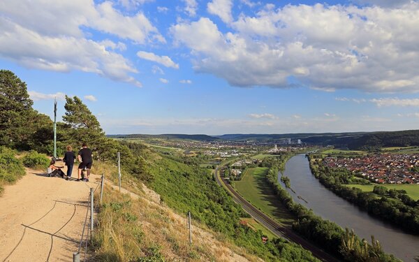
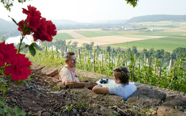
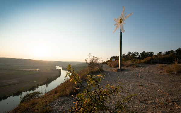
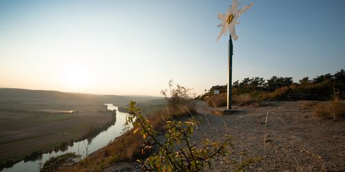
Next you reach the Edelweiss, where your gaze is no longer directed at the flora and fauna at your feet, but can wander into the distance.
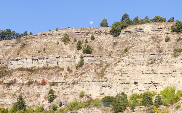
This unusually shaped, unofficial summit cross of the Kalbenstein lies 300 metres above the Main.
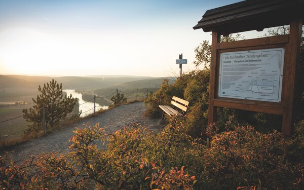
From here, the view extends far into the Main valley, over Karlstadt and across to Karlsburg Castle.
In just a few steps, you will come across a plaque with the number 9, which explains the background to the area around the edelweiss. This is part of your next destination, the geological nature trail, but you don't want to start from the end, as the tour takes you straight back to its starting point.
Firstly, it is your turn to descend to Gambach. The route takes you downhill along the rock face.
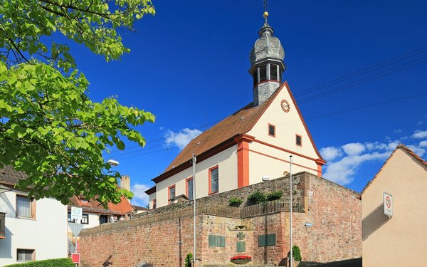
A small refuge hut soon appears, turn right here and follow the path into the village. Gambach is an old winegrowing village and was first mentioned in a document in 1237. It is located at the so-called Grenzwinkel of the Franconian wine country. The baroque church of St Bartholomew, which was only restored a few years ago, is particularly worth seeing here.
After your detour to the winegrowing village of Gambach, you return to the hiking trail. Turn right again after the steps and follow the path, which will take you directly to the start of your next destination, panel 1 of the geological nature trail.
A little note in advance: you will follow the nature trail to the point where you just turned off towards Gambach. This time, keep straight on, because you don't want to go back to Edelweiss. You already know the last signs from the way there.
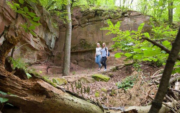
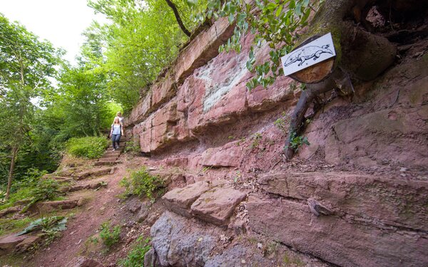
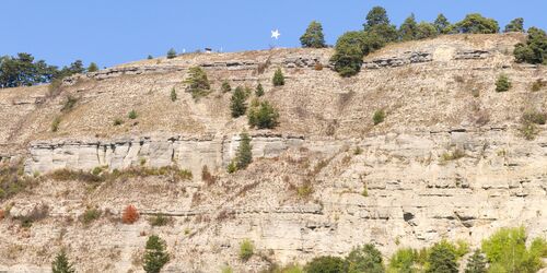
The geological nature trail offers all sorts of interesting facts for anyone who wants to learn more about the extraordinary geological conditions of the region and the local rock and dinosaur species.
It leads over a good 2 kilometres and a difference in altitude of 130 metres through geological outcrops of the Triassic period, in which the red sandstone, shell limestone and Keuper were formed from deposits. The shell limestone of the Main-Franconian Plates in the south-east meets the red sandstone of the Spessart at this point and provides a comprehensive insight into the history of the earth 200 to 250 million years ago.
Two prehistoric amphibian and dinosaur species - Mastodonsaurus ingens and Saurichnites gambachensis - were also found here.
At more than five metres long, Mastodonsaurus is one of the largest amphibians in the history of the earth. The lower jaw of the mastodonsaurus found on the Kalbenstein is now on display in the Bavarian State Collection of Palaeontology in Munich.

To explore the geological nature trail, you followed the information boards with a picture of a mastodonsaurus. Perhaps you took a break at the winegrower's hut and enjoyed the view of the Main valley.
A little further on, at the geological boundary between red sandstone and shell limestone, you leave the geological nature trail. Follow the K1 signposts again. This time, keep to the right below the rock face so that you do not take the same route as on the way there.
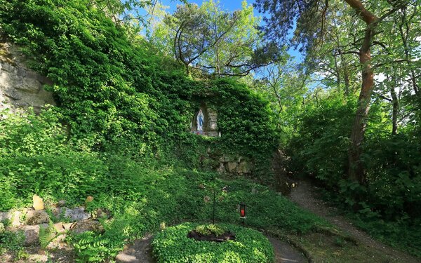
Here you will also find the Gambach Grotto. Philipp Mehler from Gambach vowed to build a place of worship during the First World War. He brought the statue of the Virgin Mary back with him from a pilgrimage to Lourdes and honoured his promise. In 1958, just in time for the 100th anniversary of the Marian apparitions in Lourdes, he and his helpers built this grotto in the former quarry in the vineyards.
Continue straight ahead to reach the Folding Hut. You are now just below the Edelweiss. You will remember the view from below up the steep rocks of the Kalbenstein for a long time, just like the panorama of the Main valley from the Edelweiss.
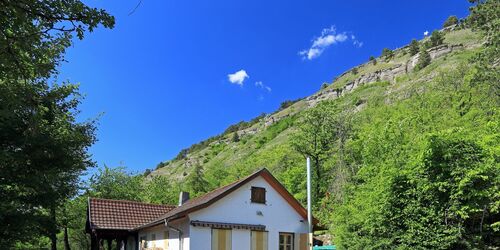
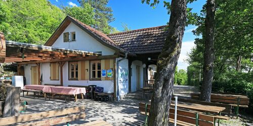
The Faltes Hut on the Kalbenstein below the Edelweiss belongs to the Würzburg section of the German Alpine Club and has a via ferrata, the Lenzsteig. It can only be used with suitable climbing equipment.
The large steep slope between the Grainberg and the Kalbenstein was formed over millions of years by the eroding force of the Main during the ice ages. The wave limestone, which is around 90 metres thick in the Edelweiss area, got its name from the mostly undulating surface structure of the rock.
The imposing, almost alpine-looking rock face made of wavy limestone was largely formed in 1784 by a large landslide, which is associated with a millennium flood of the River Main. Several other landslides have been reported up to 1975. The particular susceptibility to landslides has geological causes. There are large fissures in the limestone at this point, which run almost parallel to the slope, meaning that pieces of rock can break off again and again.
Gemündener Str. 102
97753
Karlstadt
The tour continues straight ahead and, as before, you follow the K1 signs, also along the railway line for a while, until you reach the station.
Incidentally, this is located right on the edge of Karlstadt's old town centre.
Perhaps you would like to explore the medieval centre of "Karscht", as the locals call the town, or enjoy a glass of Franconian wine before you set off?
Start/Ende
Bahnhofplatz 1
97753 Karlstadt (Main)