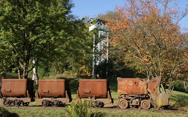
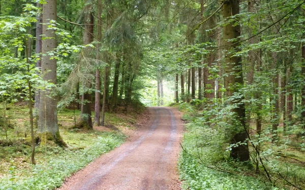
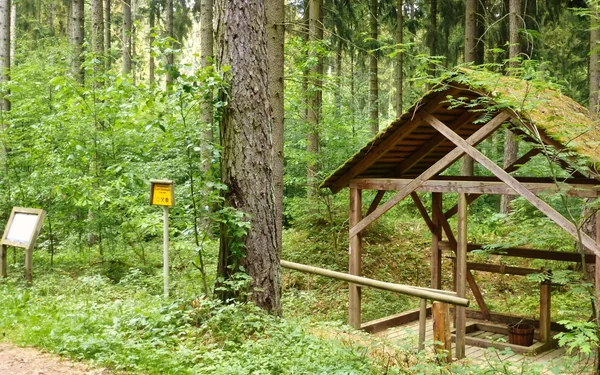
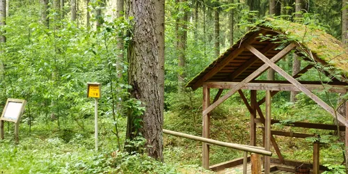
Grubenzug, Foto: Förderverein Bergbaugeschichte Stockheim/Neuhaus e.V. Stockheim, Kath. Kirche, Foto: Störfix, Wikimedia, CC BY-SA Wegabschnitt, Foto: Förderverein Bergbaugeschichte Stockheim/Neuhaus e.V. Stockheimer Steinkohle, Foto: Michael KR, Wikimedia, CC BY-SA Haspel, Foto: Förderverein Bergbaugeschichte Stockheim/Neuhaus e.V.
Tour

On the trail of the "black diamonds"

Hike on the Stockheim mountain farm adventure trail

Start
Stockheim (Oberfr)
Duration
3 h
Distance
6 km
Key facts of the tour
Bavaria had its most important coal mining areas in the Stockheim district. In the "Dachsbau" forest area, it is said to have been the dachshund of forester Christoph Friedrich Gundermann who accidentally came across hard coal in 1763. The forester was therefore granted the first mining licence. With the success of the company, a real mining fever set in from 1766. The hiking trail laid out here today shows mining equipment and installations, tells the story of Stockheim's mining history and leads to old tunnels and mining sites.
There are no refreshment stops along the way, so pack some provisions.
A hiking tour for nature lovers and culture vultures

Start and end station

Start station
Bahnhof Stockheim (Oberfr)

2 tour steps
6 km / 3 Stunden
End station
Bahnhof Stockheim (Oberfr)


Our tip: Please make sure to check your train connection and the expected capacity before you start your journey.

Schedule

Tour starts on Bahnhof Stockheim (Oberfr)


Direction

After crossing the railway tracks, follow Bergwerkstraße to the starting point of the hiking trail. The road leads through the village and past the Catholic parish church of St Wolfgang, built in 1935. At the "Alte Zeche" restaurant and the entrance to an auxiliary gallery behind it, hikers come very close to the mining culture. An auxiliary gallery was used for additional drainage of the tunnels.

Former Katharinenzeche geotope

Where once around 80,000 tonnes of coal were mined every year at a depth of 320 metres, there is now a unique place of learning.
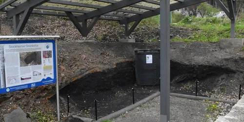
In 2005, almost 40 years after the Katharinenzeche mine was closed down, digging began again to uncover a coal seam. The coal is now visible together with all the surrounding rock. Equipped with information boards, a roof and seating, it offers visitors a unique insight into the geological composition of the coalfield.
Coal was mined in the Katharinenzeche for 200 years. It was an economically profitable enterprise, also for the town and its residents. The mine closed on 30 March 1968 and decommissioning work began. The costs of maintaining and operating the mine had become too high.

Bergwerksstraße 47
96342
Stockheim
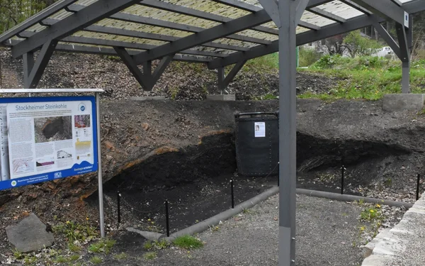
Stockheimer Steinkohle, Foto: Michael KR, Wikimedia, CC BY-SA

Direction

In addition to the geotope, dedicated volunteers have set up a mining magazine, a small museum that is also located on the site. However, it is only open on the first Sunday of the month, between Easter and October.

The approximately 3.6-kilometre circular hiking trail through the former Stockheim mining area starts from the Katharinenzeche. The sign labelled "Geo Path" provides orientation.

Around 150 metres north-east of the Katharinenzeche geotope, directly on the Geo Trail, there is another open coal seam.

It goes up a few steps and past the former site of the Maximilian Joseph mine.

The mine owner Johann Georg Carl Christopherus Winckler built a house in the middle of the forest without permission. Remains of the house were found a few years ago. An information board tells its story.

The path leads past the Ochsenbrunnen, a centuries-old natural water source.

The spoil tip and the mining roads that can be seen afterwards still characterise the forest area today.

Haspelhaus/stone coal mine Carl Christophorus

The reel house for the shaft of the Carl Christoph colliery was once located on the site of today's replica. The winches were used to transport coal and mine water to the surface.
The winches were originally operated by hand, later by machine. In the early days, up to four "winchmen" operated the winch.

Haspel, Foto: Förderverein Bergbaugeschichte Stockheim/Neuhaus e.V.

Tour ends on Bahnhof Stockheim (Oberfr)


Direction

From Haspelhaus, the hiking trail follows the Geopfad sign and leads back to Stockheim. Not far from the railway station, at Kronacher Straße 2, there is the only fast food restaurant "Food-Store" that is open daily (11 a.m. - 8 p.m.).

Tour map

Start/Ende

Bahnhof Stockheim (Oberfr)


Kronacher Str. 2

96342 Stockheim (Oberfr)

More destinations

Just a few minutes from Reutte train station, off you go on a wet adventure you won't soon forget. Discover the treasures of the Western Forests Nature Park by bike. Admire the majestic gallows oaks... Cabin "Brunnenkopf" has everything you need to relax and unwind: a picturesque backdrop and... Cycle through the picturesque Banzer Forest and admire the charming Franconian half-timbered... Experience the history of the mills along the Rodach, the Ködel dam and a unique natural oasis on... Do you like the mystery of the forest and the diversity of nature? Then this railway traveller's... Experience a free-floating steel X in the rock: the AlpspiX viewing platform directly above the... Visit Dingolfing on an excursion by train! Here, the time-honoured ducal castle bears witness to... In the Rottal valley you will not just find an exercise trail, but an entire fitness park. You can... Explore the spiritual treasures of Mammendorf on this hike. From the churches, the route continues...