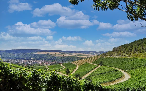
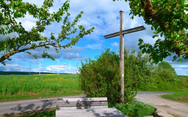
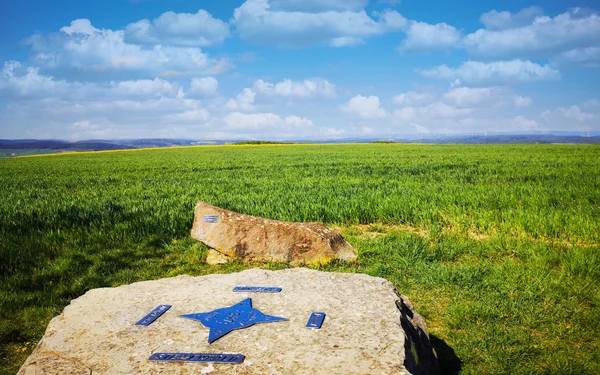
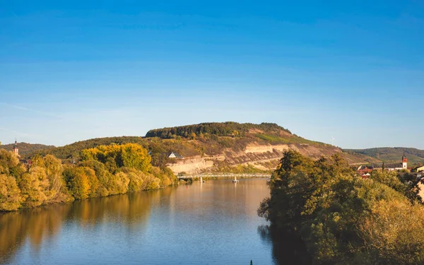
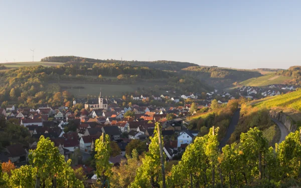
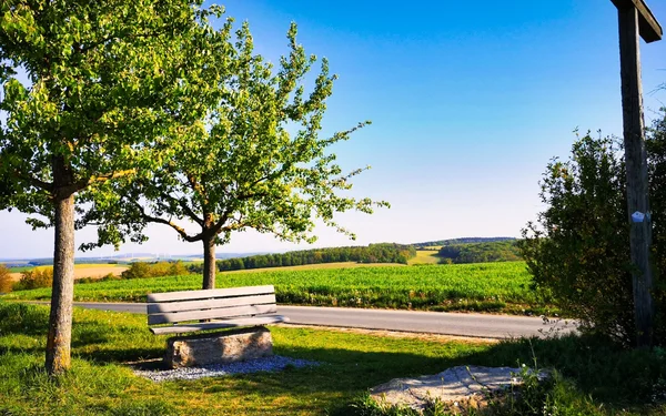
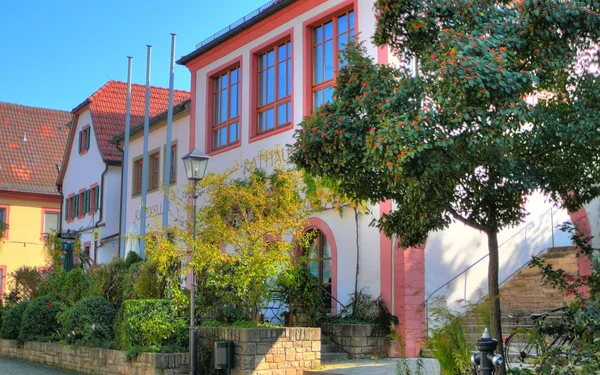
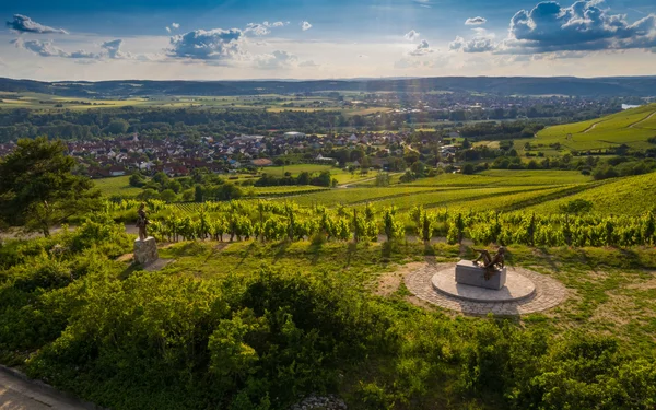
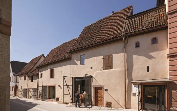
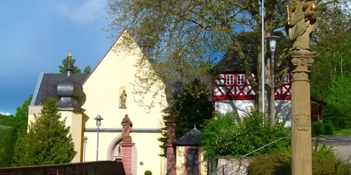
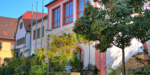
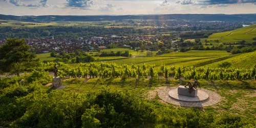
Weinberge Thüngersheim, Foto: Jil Abfalter Aussichtspunkt Toter Mann, Foto: Reinhold Meurer Breitfeldhoehe, Foto: Jil Abfalter Main in Zellingen  , Foto: Juergen Storch, Markt Zellingen Retzstadt, Foto: Volker Muether, ZweiUferLand Tourismus Toter Mann, Retzstadt, Foto: Jil Abfalter Zwei Ufer Panoramaweg, Thüngersheim, Foto: Jil Abfalter Wallfahrtskirche Maria im Grünen Tal, Retzbach, Foto: Reinhold Meurer Rathaus Retzstadt, seitlich, Foto: Reinhold Meurer terroir f  , Foto: Rolf Nachbar, Lizenz: Gemeinde Thüngersheim WeinKulturGaden, Foto: Florian Hammerich
Tour

On the ZweiUferPanoramaweg from Retzbach to Thüngersheim

family friendly
All ages
Historically Relevant
Hiking Trails
all-season
Geologically Interesting
For Adults

Hike along the ridges above the Retztal valley from the pilgrimage site of Retzbach to Thüngersheim and enjoy the view. Plan your excursion by train now!

Start
Zellingen
Duration
4 h
Distance
16 km
Key facts of the tour
Starting from the pilgrimage site of Retzbach, you hike along the ridges above the Retztal valley via Retzstadt to Thüngersheim. Prepare yourself for a good 380 metres in altitude. The climb is well worth it. Time and again, your gaze sweeps far into the countryside as far as Würzburg, the Steigerwald, Spessart and the Rhön. The important pilgrimage church "Maria im grünen Tal" invites a moment of reflection and fascinates hikers interested in culture. And, of course, you will wander through the vineyards.

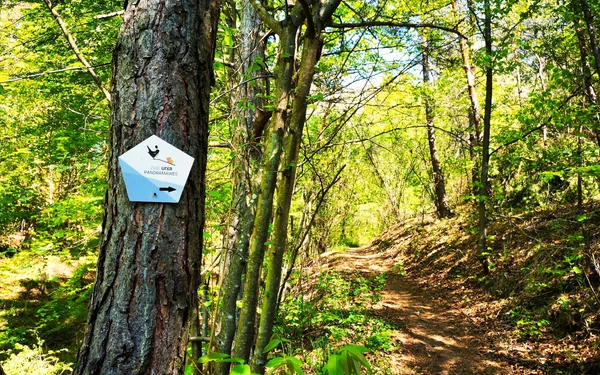
On your hike, follow the markings with the blue pentagon, the blackbird and the mouse. There are shell limestone benches, wave benches and shelters along the way where you can take a break.
A hiking tour for nature lovers, culture vultures and explorers

Start and end station

Start station
Bahnhof Retzbach-Zellingen
4 tour steps
16 km / 4 Stunden
End station
Bahnhof Thüngersheim

Our tip: Please make sure to check your train connection and the expected capacity before you start your journey.

Schedule

Tour starts on Bahnhof Retzbach-Zellingen

Direction

Leave the railway station on the right and follow Bahnhofstraße, turning right downhill at the old half-timbered town hall. 100 metres after the "Vogelsang" hotel, turn left onto the Pfarrer-Seitz-Weg footpath along the Retz stream. At the end, a climb up the steps into Retzstadter Straße awaits you. The route now leads you to the pilgrimage church "Maria im grünen Tal".

The Retzbach pilgrimage church is surrounded by nature. The neighbouring health garden invites you to explore and actively relax. Behind the church, the Way of the Cross, consecrated in 1880 and consisting of 14 stations, leads up the hill.

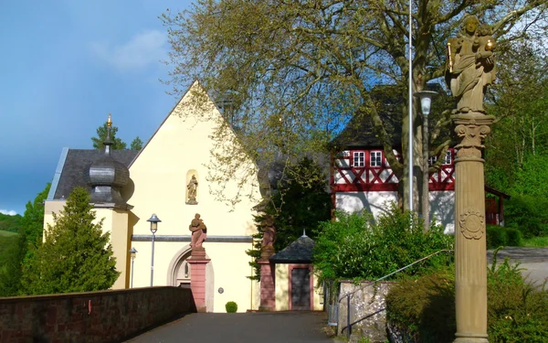
Pilgrimage church "Maria im Grünen Tal"

The 13th century place of pilgrimage is one of the oldest in Franconia and is visited by thousands of pilgrims every year. People have been visiting the smiling Madonna of Grace in the chancel of the chapel since 1229. It is said to have been found around 1200 by the Lords of Thüngen while hunting, whereupon they donated the chapel. Its original building still forms the east choir today, but was considerably enlarged in later centuries. The nave, baroque west façade and the stair towers with onion domes were built in the 17th and 18th centuries. Various renovations were necessary after the roof of the nave collapsed during a thunderstorm in 1969.

Kapellenweg 2
97225
Zellingen

Phone: 09364 9930
Email Address: pfarrei.retzbach@bistum-wuerzburg.de
Wallfahrtskirche Maria im Grünen Tal, Retzbach, Foto: Reinhold Meurer

Direction

Walk a short distance back along Retzstadter Straße. Follow the staircase on the right, which leads under the MSP7 (district road in the Main-Spessart district). Now continue right along the Hauenweg to the rest area with a shell limestone bench and panoramic view. After a short rest, continue uphill, past the cross on the left, then straight ahead for a long time to the "Toter Mann" viewpoint. Here you are 350 metres above sea level. The view stretches far into the Spessart and the Rhön.
From here you come to a crossroads. Turn right and follow the Retzstadt-Thüngersheim local road for around 200 metres. Now keep to the right. The road goes slightly downhill here. At the next opportunity, turn left briefly and then immediately right again at a sharp angle. Keep left at the fork in the road. Follow the route through the vineyards to Kreuzschlepper, where another panoramic view and a rest stop await you. The path now leads downhill and offers you a view of the "village of paths" of Retzstadt. On the municipality's website, you will find 10 themed hiking trails alone, which have been laid out starting from the town hall in the surrounding area and through the village. These include the Poets' Trail with changing poems, the Forest Nature Trail, the Planets' Trail, on which over 6 kilometres of knowledge about our solar system is vividly conveyed, as well as the Fairytale Trail and the Reflection Trail.
Cross the MSP7, pass the half-timbered house along the way and follow the path towards the town hall. The tower of St Andrew's Church shows you the way.

Retzstadt Town Hall with Ratskeller and St Andrew's Parish Church

In addition to the municipal administration, the Retzstadt town hall is home to the "Ratskeller", now an Italian restaurant. The construction of the town hall building rests on piles driven into the ground. The ground floor probably dates back to the 18th century, while the upper floor was added in the 20th century. To the left of this is the "Sinder" house, now part of the town hall, with its typical round cellar arch and crippled hipped roof, a so-called "Einhaus", a single house where living and farming took place under one roof. Above the town hall is the parish church of St Andrew. It was built between 1726 and 1730 according to plans by the famous Baroque master builder Balthasar Neumann, the creator of the Würzburg Residence. There was an older predecessor building, as evidenced by the Romanesque elements on the staircase. Remains of an old church were also found, which is said to have been built around 1250.

Rathausplatz 5
97282
Retzstadt

Phone: 09364 6059740
Email Address: rathaus@retzstadt.de
Thursday: 05:00pm - 11:00pm
Friday: 05:00pm - 11:00pm
Saturday: 05:00pm - 11:00pm
Sunday: 11:00am - 11:00pm
Rathaus Retzstadt, seitlich, Foto: Reinhold Meurer

Direction

If you would like to fortify yourself for the rest of your journey and the Ratskeller has not yet opened its doors, why not pay a visit to the Weber bakery? The bakery is located just 70 metres from the parish church at Hauptstraße 27, 97282 Retzstadt.
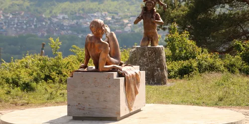
Walk along Unterdorfstraße, then turn half-left into Thüngersheimer Straße, past the kindergarten, primary school and DJK sports park, then continue uphill to Breitfeldhöhe. There is a nice place to have a small picnic here by the benches. At 387 metres, the Breitfeldhöhe is the highest point on your hiking tour. It offers an all-round panorama with views of Würzburg, the Spessart, Rhön and Steigerwald. Follow the path as it zigzags a little further through the fields, passing a model aeroplane site and then taking a sharp right downhill. After about 300 metres, you will come to a dirt track and, through a small dip, you will descend slightly again, following a somewhat hidden forest path on the left. The trail continues downhill towards the valley path in the Thüngersheim vineyards, then turns left and after a few metres climbs slightly left again. Here you can take a detour to the terroir f Wine & Mythology. Follow the signposts!

terroir f wine & mythology

Anyone who has climbed up to this terroir f, one of the magical places of Franconian wine with a sweeping view over the vineyards, will find themselves in Greek mythology. Visitors are greeted by the goddess Ariadne. Here you can find out why she enjoys the sun above the "Thüngersheimer Johannisberg" vineyard. After all, she became famous for her "red woollen thread", which she used to help Theseus find his way out of the Minotaur's labyrinth. But Ariadne's story went even further: Theseus gave the princess the slip - but she was married by Dionysus, the god of wine, and rose to become the first wine queen in history. And so it is not surprising that here, in the vineyards of Thüngersheim, you also come across Dionysus, also cast in bronze, carrying his and Ariadne's son Oenopion on his shoulders. When he was an adult, Oenopion was regarded as the first vintner in Greek mythology.

Am Fischberg
97291
Thüngersheim

terroir f  , Foto: Rolf Nachbar, Lizenz: Gemeinde Thüngersheim
terroir f - Wein und Mythologie, Foto: Herbert Ehehalt

Direction

Return to the main path and follow the route downhill to the Retzstadter Tor in Thüngersheim. The former northern town gate with its half-timbered construction dates back to 1609. From here, continue straight ahead along Hintere Gasse until you reach Untere Hauptstraße. Turn left and you will pass the town hall and continue to the WeinKulturGaden.

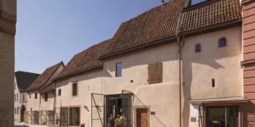
WineCultureGaden

The church arcades of Thüngersheim are considered to be one of the most valuable and now, following their restoration in accordance with the preservation order, also one of the most fascinating examples of medieval architecture. In the Middle Ages, barns were usually small outbuildings on fortified churches, which were intended to provide shelter for the inhabitants in times of need and were otherwise used to store everyday necessities. Until the beginning of the Thirty Years' War, these church barns served as storage rooms, which were protected by the church and surrounded the churchyard. Significant parts of this complex have been preserved in Thüngersheim for many centuries. Renovation work was carried out between 2010 and 2015 and the vaulted ambience is now used for wine tastings, music events, readings and regularly changing art exhibitions. The themes of wine and culture in Thüngersheim are presented in a newly installed permanent exhibition.

Kirchgasse 2
97291
Thüngersheim
Phone: 0170 41 98 447
Email Address: info@weinkulturgaden.de
Saturday: 10:00am - 06:00pm
Sunday: 10:00am - 06:00pm
WeinKulturGaden, Foto: Florian Hammerich

Tour ends on Bahnhof Thüngersheim

Direction

If you're feeling peckish after this hike through mountain and valley, you only need to take a few steps to the right, as the "Landgasthof zum Bären" restaurant, Kirchgasse 1, 97291 Thüngersheim, Tel. 9364 7267, is located near the WeinKulturGaden. Open Wed-Sun 11:30 - 14 and 17 - 22. Here you can enjoy hearty and good home cooking and a good drop of regional wine. If you arrive outside opening hours, Weber's country bakery at Untere Hauptstraße 22 not only offers sweet treats, but also hearty snacks to satisfy your hunger.
The railway station is just a stone's throw away. Well-fuelled and full of wonderful experiences, the train will take you home again.

Tour map

More destinations

Would you like to explore the pilgrimage route in Bavaria? We recommend short pilgrimage routes... Take the railway into nature to Wolfsee lake, viewing tower and gypsum quarry. During your hike in... Cast aside your shoes and socks and treat your senses to a walk across flagstones and spruce cones... The idyllic region of Gablingen is located around ten kilometres north-west of Augsburg. You can... Off to the Franconian Lake District by train! This hike combines nature enjoyment, birdwatching and... Want a different kind of hiking experience? In Bavaria, you can take an alpaca or donkey along for... If you want to experience a pilgrimage route while only taking a short hike, you should set out... Up to the most northerly lookout point in Bavaria: the Thüringer Warte tower near Ludwigsstadt is... The Osterseen lakes in Iffeldorf offer Caribbean flair in the centre of Upper Bavaria. Discover the... Simply magnificent! The Franconian Mountain Path, with a total length of almost 430 km, stretches...