
Bahnhofstraße 61
91757 Treuchtlingen


Travelling by bike in the footsteps of the Romans. On this tour from Treuchtlingen, you will discover the Roman town of Weißenburg and the largest technical cultural monument of the early Middle Ages
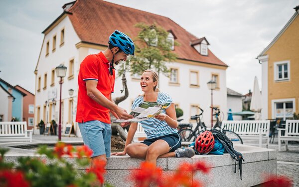
A cycle tour for culture lovers and explorers
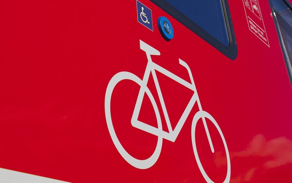
Arrive relaxed and hire bikes from local hire companies. The capacity for taking bikes on the trains is limited and it is not possible to guarantee that you will be able to take your own bike with you, depending on capacity utilisation.
Our tip: Please make sure to check your train connection and the expected capacity before you start your journey.
There are 72 bicycle parking spaces in the immediate vicinity of the railway station.
Bahnhofstraße 61
91757
Treuchtlingen

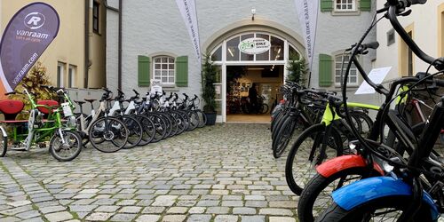
From the railway station, head south along Bahnhofstraße until you reach the town hall. Here you turn left into Hauptstraße and follow it until you turn right into Kirchenstraße, where you will immediately find the Energy Bike Systems bike hire shop.
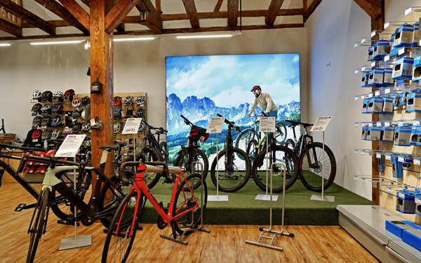
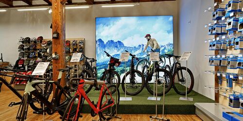
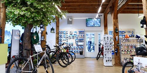
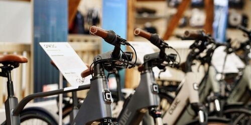
Energy Bike Systems in Treuchtlingen is a competent specialist shop, workshop and bike hire all in one. The experts will find the right bike for every occasion in their extensive fleet - from step-through bikes to mountain bikes, with or without a motor.
Kirchenstraße 2a
91757
Treuchtlingen
Back on the main road, turn right and cycle eastwards out of Treuchtlingen.
After a stretch parallel to the road, veer slightly to the left and cycle along the Schambach into the village of the same name.
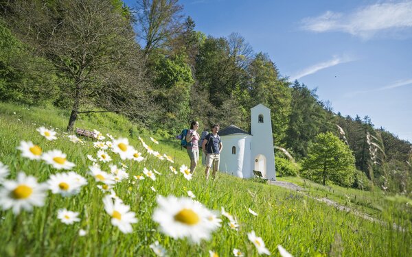
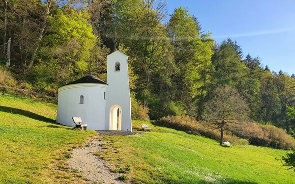
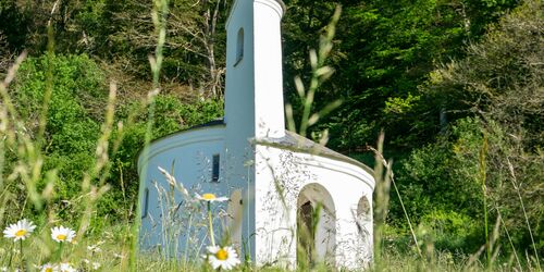
After a left turn and the Gunthildisbrünnlein, you will see a shining white chapel on the left.
This ecumenical new building from 1995 has the basic shape of an ammonite and is therefore also known as the "snail shell of God". Next to it you will find the uncovered remains of an early medieval pilgrimage centre. The St Gunthildis Chapel was first built in the late 11th century and then enlarged and rebuilt 200 years later.
St2216 zwischen Treuchtlingen und Suffersheim
91781
Weißenburg in Bayern

Continue along the Schambach valley towards Suffersheim. Shortly before the village, turn left between the Potschmühle mill and the playground on Haardener Straße.
A short, steep climb awaits you (approx. 1.6 km, approx. 100 m ascent of up to 10%). Head north through the forest first to Haardt and then on to Weißenburg.
Roll past the Burgwald theatre and along Holzgasse to the largely preserved town wall, which dates back to the 12th and 13th centuries.
In Bachgasse, you may have the opportunity to stop for refreshments at the Bräustüberl brewery in the original Schneider brewery (Bachgasse 15, 91781 Weißenburg, tel. 09141 2407). Here, Schneider Hell, Märzen and wheat beer are served exclusively with a modern interpretation of Middle Franconian cuisine.
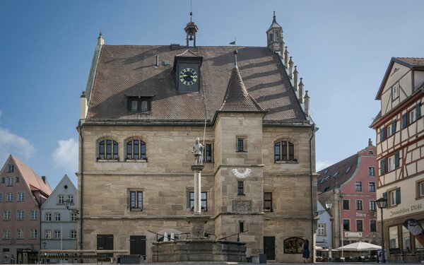
Feel free to explore the picturesque old town centre. Beyond the market square and town hall square you will find your next destination: the Roman Museum.
The foundation of the Roman Museum goes back to the chance discovery of an amateur gardener. In autumn 1979, while planting an asparagus bed just outside the town of Weißenburg, he first came across rusty pieces of iron. Excavations subsequently uncovered 114 very different objects, including votive tablets, sacred vessels, tools, parade equipment and 17 bronze figures of gods that were unique in terms of their quality and state of preservation. The gardener had probably stumbled upon the hoard of a looter. The "Weißenburg Treasure" is one of the most important hoard finds in Germany. Today it is assumed that it was buried in the 250s AD. AD, when the Alemanni invaded the area.
One year after it was uncovered, the Free State of Bavaria acquired the find. The Roman Museum was founded as a branch museum of the Munich State Archaeological Collection and opened in 1983. It reopened in 2017 with a newly designed exhibition following extensive renovation work. It tells the story of the "Weißenburg Treasure" and life on the Limes. What was everyday life like for soldiers in the fort, how did traders and family members live in the camp village? And what do we know today about the cultural exchange between the Romans and Germanic tribes?
Doktor-Martin-Luther-Platz 3-5
91781
Weißenburg in Bayern

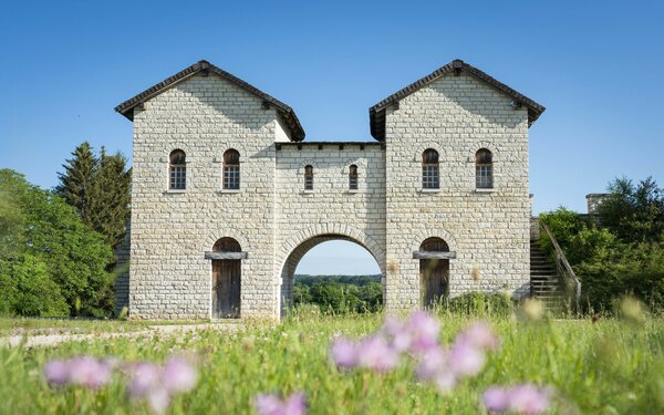
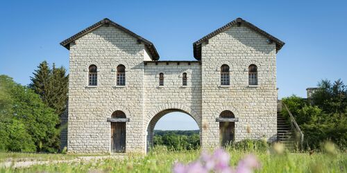
Now it's time to see the Roman sites for yourself. To do this, leave the old town via Ellinger Straße through Ellinger Tor.
The Ellinger Tor is considered one of the most beautiful town gates in southern Germany. The tower houses Weissenburg's historic council library.
Turn west along Lehenwiesenweg, follow the railway tracks southwards for a short distance and then turn right into Am Römerlager. You have now reached the equestrian fort of Weißenburg, whose ancient name Biriciana is still in use today.
The fort of Weißenburg or Biriciana is located around five and a half kilometres south of the Upper German-Rhaetian Limes on the western edge of the town of Weißenburg on a slight bump above the Schwäbische Rezat. The Biriciana station was once the most important Roman troop location in the section of the Limes now recognised as a UNESCO World Heritage Site.
The Ala I Hispanorum Auriana cavalry unit probably built the Biriciana fort out of wood and earth around the year 100. It was situated in a strategically important location and was enlarged from 2.8 to 3.1 hectares half a century later. New stone enclosure walls were built directly in front of the wood and earth construction. In the end, the fort measured 174 by 179 metres, with the corners of the square rounded and equipped with towers. Scholars date its destruction to around 253, when the Alemanni invaded the area.
In 1990, the entire area became an archaeological park. The contours of the defensive walls and the principia, the staff buildings at the centre of the camp, have been preserved and the gates have been partially reconstructed in their original size on the original foundations. According to the latest research, the imposing reconstructed north gate was probably even one storey higher.
Am Römerlager 16
91781
Weißenburg in Bayern
As was customary in Roman times, family members, retired soldiers, traders, craftsmen and innkeepers always settled near the garrisons. Around 2500 people are thought to have lived in the vicus of Biriciana in Weißenburg. Once you have passed through the fort, it is only a stone's throw to the "Great Baths" of the Roman settlement.
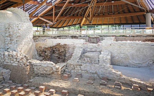
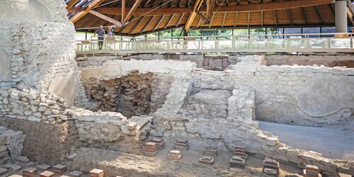
The Roman thermal baths of Weißenburg are one of the few bathing facilities from Roman times that have been preserved on Germanic soil. The "Great Baths" originally date back to the time when the nearby cavalry fort was built around the year 100 and were extended several times or rebuilt after being destroyed in the Marcomannic Wars around the year 180. In the course of the Alemannic invasions, the complex suffered considerable destruction around the year 230 and was abandoned at the end of the 250s.
In Roman times, baths were used for health and hygiene, but they were also a place of relaxation and an important social meeting place. The Great Baths of Weißenburg were a luxurious facility built in the ring type with dimensions of 65 by 42.5 metres. There was underfloor heating and glass windows, some pools and floors were lined with polished limestone slabs and the walls were decorated with murals. Slaves heated the baths day and night with wood and charcoal.
After its discovery in 1977, the large bath complex was researched, preserved and partially reconstructed. Today it lies under a tent-shaped protective structure and can be explored on a permanent tour.
Am Römerbad 17A
91781
Weißenburg in Bayern
Even two millennia ago, people knew how to enjoy water. The Romans were probably ahead of their time in some respects, but Germanic history can also impress with technical water marvels. Your next destination bears witness to this.
Tip for on the way: there is a toilet block at Karlsgraben, which is open from Easter to October.
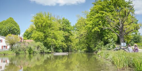
One of the greatest technical cultural monuments of the early Middle Ages lies between the Altmühl and Rezat rivers. The Fossa Carolina, also known as Karlsgraben, was the first attempt to connect the Rhine, Main and Danube with a waterway. Even today, a 500 metre long stretch of water at the edge of the village of Graben and the adjoining earth embankments up to ten metres high bear witness to this attempt.
The village of Graben lies on the main European watershed. Here, the Rhine and Danube river systems come within a few kilometres of each other and are only separated by a slight rise. Emperor Charlemagne wanted to capitalise on this geographical proximity. In 793, he had a canal dug around 3,000 metres long to enable ships to sail to the south-east of his empire, where he was at war with the Avars.
Whether or for how long the canal was actually used is still unclear today. Since archaeological investigations began in 2012, there has been increasing evidence that it was not completely navigable, as previously assumed. Chroniclers reported that persistent rain and the marshy ground had become a problem during construction. So was the ambitious project ultimately cancelled or was the passage too complicated and the tolls for traders too high?
In any case, what can be seen of the Fossa Carolina at Graben today is reminiscent of one of the largest engineering and geological construction projects of the Middle Ages. It is probably the most important ground monument from Carolingian times in Franconia and is one of the "100 most beautiful geotopes in Bavaria", selected by the Bavarian State Office for the Environment.
Karlsgraben 7
91757
Treuchtlingen
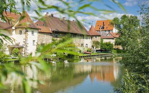
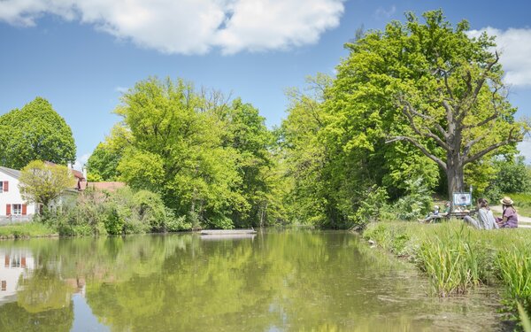
Your final stage now takes you back to Treuchtlingen. On the other side of the railway tracks, you cycle along the banks of the Altmühl through open fields.
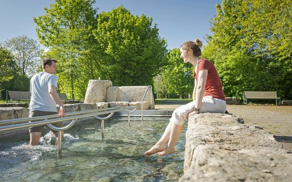
At the spa gardens, you have the opportunity to revitalise your tired legs in a Kneipp pool.
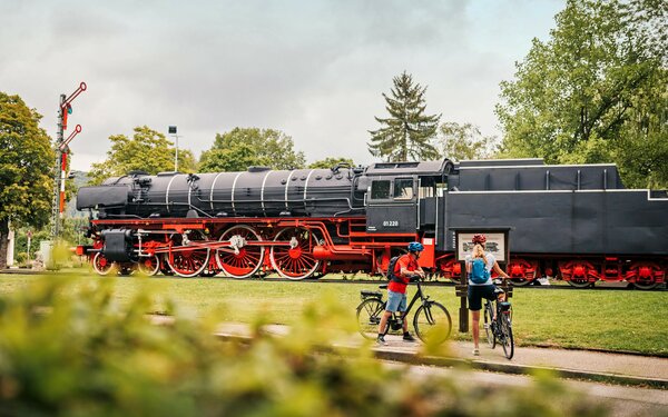
To return your bike, turn left at the Treuchtlingen locomotive and follow the route back to the bike hire shop.
From here, take the same route to the railway station that you used to get here.
Start/Ende
Bahnhofstraße 61
91757 Treuchtlingen